Posts Tagged ‘Wanaka Region’
Every single one of our friends who has been to New Zealand told us that Wanaka was amazing, and they were right. Though the weather was not ideal when we were in the area, we still fully enjoyed the amazing landscape that we have come to expect from this magical country.
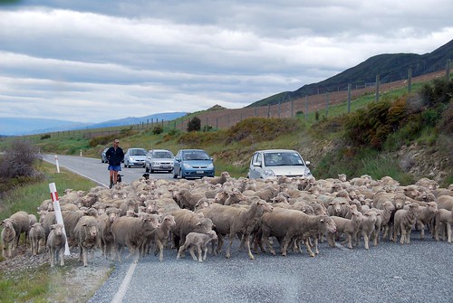
But first…sheep crossing!!!
Wanaka
The Wanaka landscape is dominated by two absolutely enormous lakes: Lake Hawea and Lake Wanaka. We saw Lake Hawea on our drive in, but didn’t really spend much time there except to snap a few photos of the view.
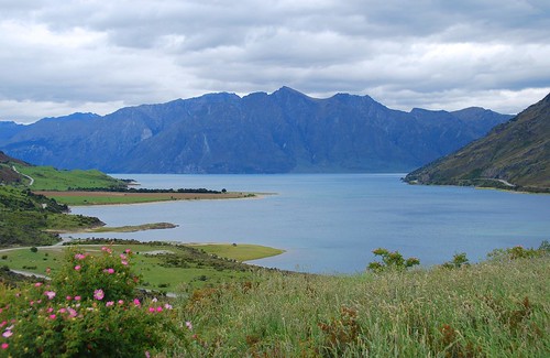
Lake Hawea.
Our exploration of this area started with a hike up Mt. Roy, overlooking Lake Wanaka and the city. The hike started off in private farmland where there were sheep nursing their young lambs and the trail was (thankfully) nice and grassy (spongy and easy on the feet!).
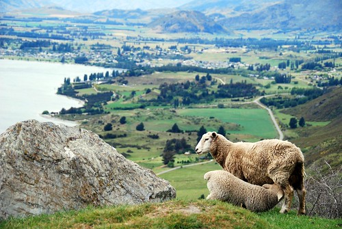
I want num-nums!!! Overlooking Lake Wanaka and the town of Wanaka…
Eventually we crossed over into public land where the landscape changed pretty drastically and there were large tufts of mustard-colored native grasses dotting the trail.
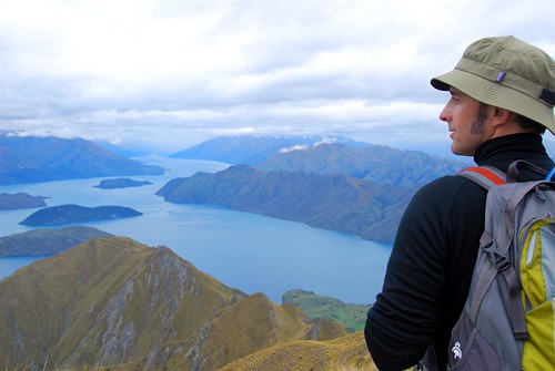
Jeremy overlooking Lake Wanaka.
OK, if it looks like we’re pretty high up in the above picture, that’s because we were. This was the biggest hike we had done in NZ. The trail markers estimated the return hike at 5 hours, and as we’ve mentioned before, Kiwi trail estimates are extremely accurate. It was a sustained 3 hour hike straight up a steep hill. The ascent wasn’t so bad, actually—it was the downhill that really made it’s mark. That is a solid 2 hours going downhill…our knees, quads, and booties really paid the price for that little excursion.
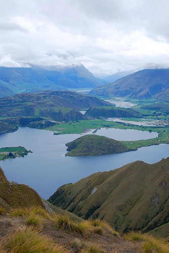
At the summit overlooking Diamond Lake.
Mt. Aspiring National Park
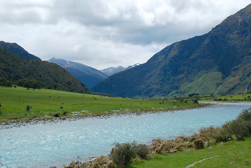
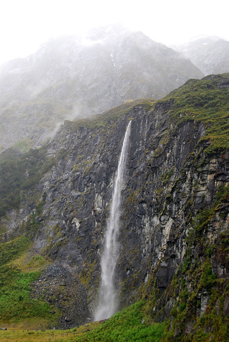
The following day we drove into Mt. Aspiring National Park, about an hour from Wanaka. We heard about a nice hike there to Rob Roy glacier (Kiwis and their glaciers!). The hike started off along a beautiful river…
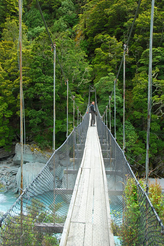
…and then you cross a swing bridge…
…and hike for about 2 hours until you hit this:
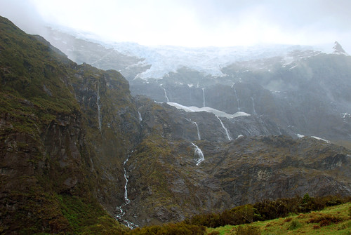
Unfortunately, the weather turned kinda sour when we hit the end of the trail, and we were rained on pretty heavily during the return to the car. It wasn’t so bad, actually…it was kinda fun! There were a lot of waterfalls in the mountains as a result of the weather and it made for a pretty scenic hike back to the car.
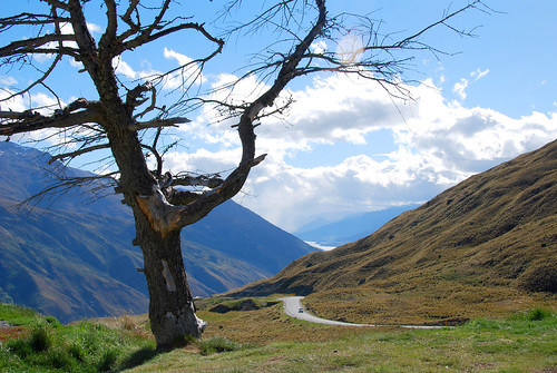
Of course, as soon as we got out of the national park, the sun was shining as bright as could be, which made for a breathtaking drive into Queenstown:
We stayed in Queenstown just long enough to see a bit of the town and buy groceries for the night…this is the most heavily touristed place in the south island we were told by a couple of people to avoid it. Queenstown is known as the “Xtreme sports capital” and there are bungy jump centers all over the town centre. As a result, we had pretty low expectations of the place, but what people failed to mention was how incredibly gorgeous the area is. Nestled at the base of The Remarkables (a mountain range that offers skiing in the winter), Queenstown and it’s bordering Lake Wakatipu are absolutely stunning. Still, it does have the feel of a resort town so we didn’t mind spending only a few hours in the area.
Wanaka is an amazing place and this is the one area on the south island where we wish we could have stayed a little longer. I guess it will have to wait for our next visit to NZ?
ABOUT
Hope is 5 foot 11. Jeremy is 6 foot 4. Together we are 12FOOT3. This is our around-the-world travel blog. Come see the world from our point of view.